As opposed to Neil Diamond’s ‘Hot August Night’
I decided on a day hike today. One that I’ve taken plenty of times before, but not in the heat of an early August morning. Reminds me that I really like this trail in the late fall, winter, and early spring.
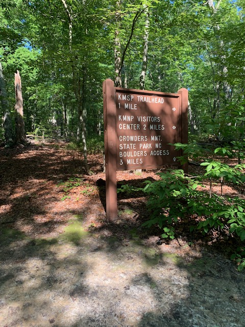
20 minutes from home, the Boulders Access to the Ridgeline trail is pretty much in the middle of the Kings Mountain National Military Park and the Pinnacle in Crowders Mountain State Park. A trip to either end, and back, is about 11 miles. I figured since all I had been doing lately is the air-conditioned YMCA, I should probably do the easiest section, which is to the military park and back. Not only that, but there is a shorter way back that makes the trip only 9.4 miles.
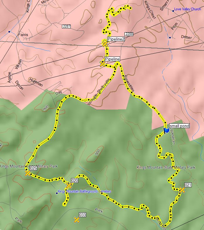
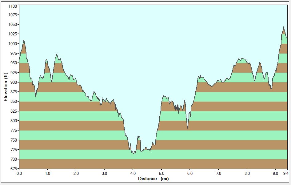
Below is the track from my Garmin.
The south end of the Ridgeline Trail crosses two gas pipelines and the NC/SC State-line. The second pipeline crossing area was being worked on; plenty of grading equipment and red mud. The trail also uses a couple of other old dirt roads; the next video shows the crossing of the Yorkville/Shelbyville road (which I use as a return); the next runs mostly parallel with part of the national park boundary. This portion shows the mostly flat part of this trail.
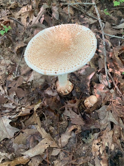
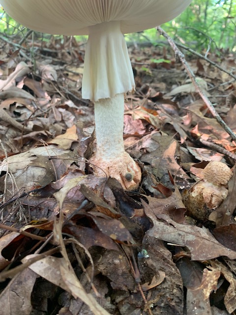
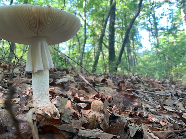
Along the next bit of trail, I found a mushroom and used an app on my phone to identify it as a “Blusher”; a genus of Amanita A. rubescens. The app said it was edible, but I didn’t try it. (think of the people who ate these first: a) Hey, Bill died right after eating that, b) John saw god for a week after eating that, c) Henry survived.) I also saw a small box turtle the edge of the trail.
The Ridgeline Trail comes to an end at the trail from the State Park to the National Park. Back in the 70’s, we walked from the campground to the National Park almost every time we camped there. This junction was a good spot for a bit of rest and some pepperoni/salami/cheese.
The next portion of trail pretty much follows Long Branch for a way to the Visitors Center at the National Park, with a few uphill climbs (from about 4 to 5.5 miles on the below profile). Along the trail near the creek I saw several spots beside some trees that looked like grey ash. On looking closer, I found several branches above them covered in white aphids – it looked like ants were ‘farming’ them.
Just before I got to visitor center at the national park, I passed a spot where they were giving demonstrations of flintlocks firing. They asked if I wanted to join the audience; I told them no, that I had joined and fired one way back when.
At the visitor center, I wetted a cooling towel, used it and ate the rest of my salami/pepperoni/cheese.
By now, I was soaked in sweat from head to toe and tired. I decided then to take the shortest way back, but took no more video. The walk back was just hot and tiring.
I’m glad the MAX AC in my truck works.
Here is a profile of the hike. Keep in mind there is only about 300 ft elevation change; the peaks weren’t nearly that ugly.
I knew going in to the walk that I would likely be tired at the end, and I was; I also got the first blisters on my foot than I’ve had in several years – maybe I should have changed socks halfway through. As John Muir said, “In every walk with nature one receives far more than he seeks.“
