Cataloochee Area Backpack
6/17 – 6/20/24
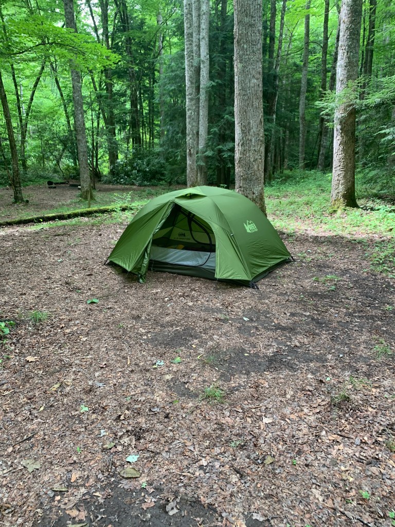
I made plans to hike a short loop in the Cataloochee area of the GSMNP, partly to use a new tent (REI’s half-dome), but as much to get on the trail again. Six months off was a big pain.
Mid-summer ’23, I started to play Pickleball and got addicted. I got better than most of the beginners pretty quickly, and started playing on “open play” days with more advanced players. Sometime in mid-September, I tore a piece of cartilage in my left knee so I wore a brace while playing and waiting for my ortho appointment in October. Then in the first week of October, I tore my right calf muscle (I didn’t know you could do that). So, I wore a boot for six weeks (another ortho trip), and to my knee ortho trip the next week. Needless to say, I was a bit pissed. Well, I had knee surgery (two pieces were torn) just before Christmas, so hiking the fall and winter was out of the question. I did start on the elliptical and weights at the Y in mid-late February, and Pickleball again (with the beginners first) in April. (BTW, I’m almost a 4.0 level now (1/11/25) and only play with the intermediate/advanced players and “open play”, unless the beginners need help on Tuesdays and Thursdays.)
My plan included staying overnight in Sylva with my dad and step mom. I left Sylva on the 17th and went through Waynesville – I had to get a parking sticker for the GSMNP – then drove into the Cataloochee valley. Easy drive and found the parking at the end of the road with no problems. No cell service though – the existing map on my phone got me to the parking, but didn’t show up when I left – no biggee though – the road had no turns until cell service returned.
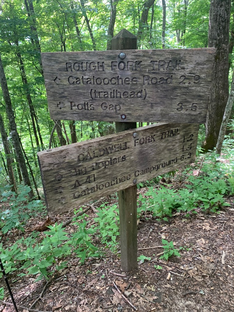
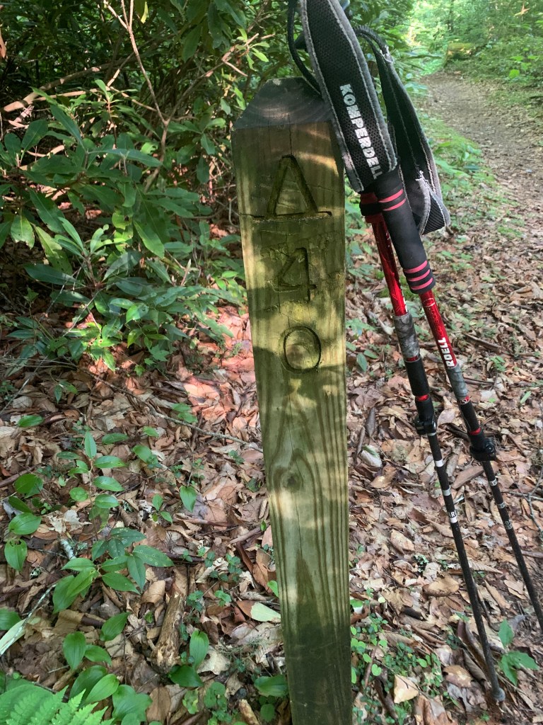
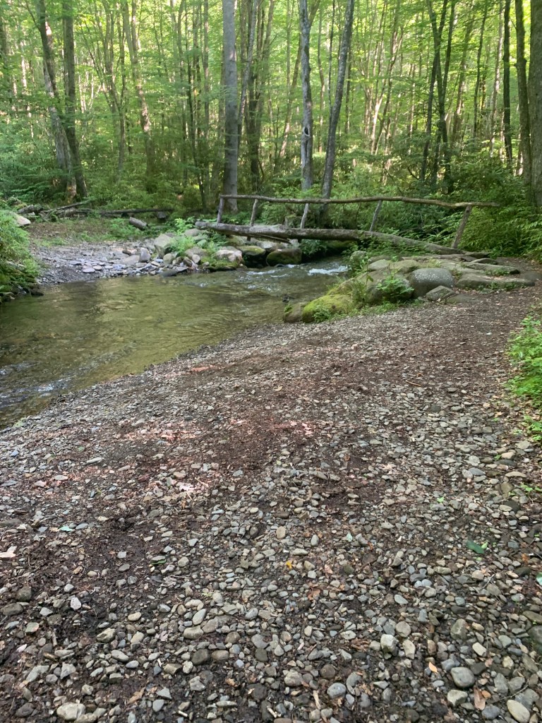
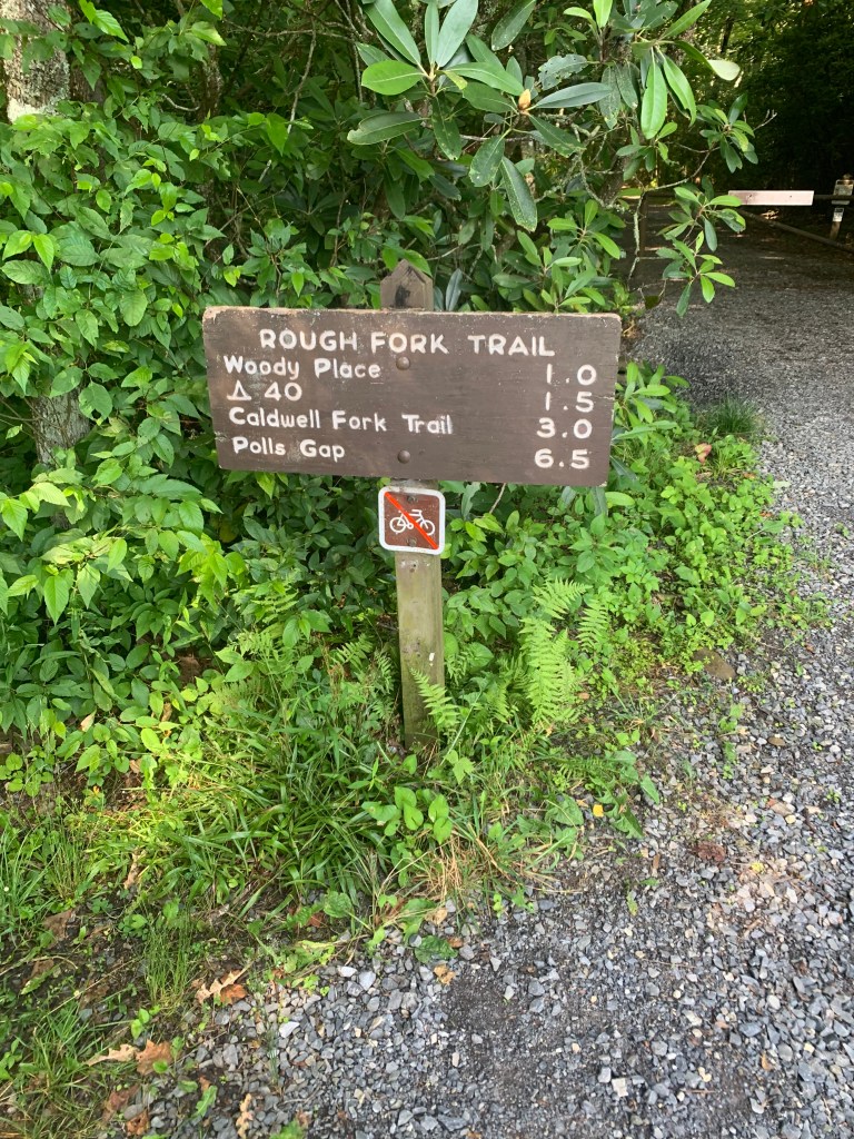
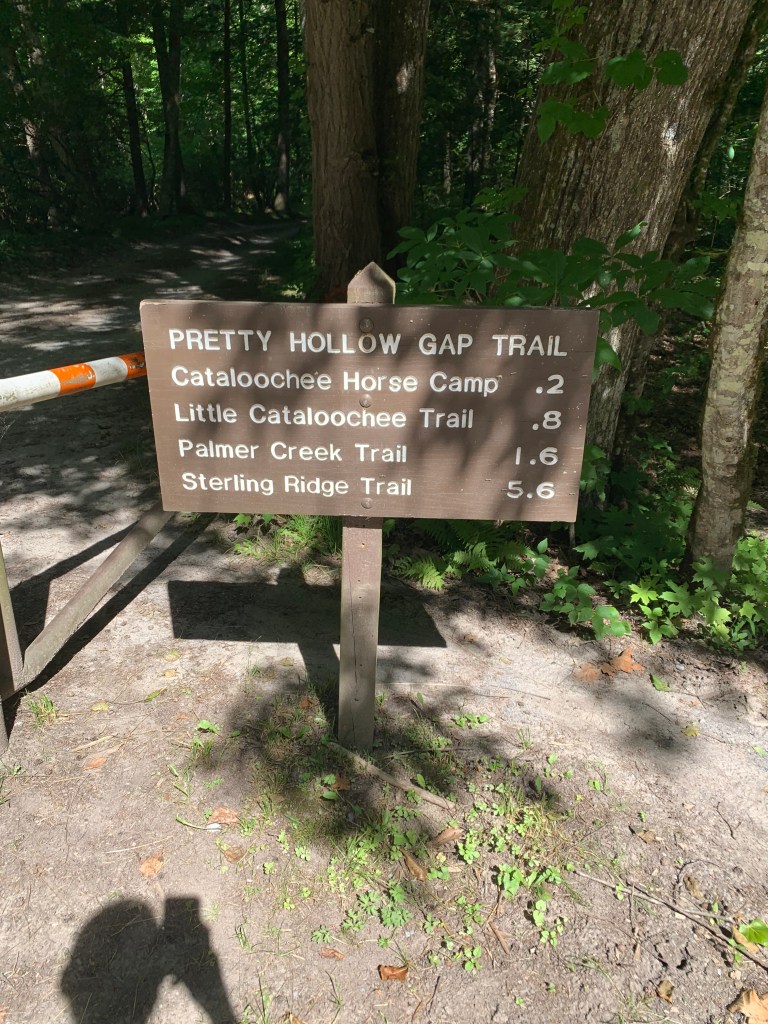
The trail started back along the road a bit to the trailhead for the Big Fork Trail. The trail went south-southeast uphill immediately, so sweating began (June is hot/muggy hiking in the Smokies). My trail legs were non-existent. I had lots of stops to drink and suck wind (2 videos at 2 of the stops below). At the top of the ridge of the trail, I met 5 folks on horses and spoke with them awhile. The trail then went downhill until it crossed a creek via a footbridge and ended at the Caldwell Fork Trail. The Caldwell Fork Trail runs generally NE/SW mostly along the creek; it begins near the Cataloochee Campground and ends at the Rough Fork Trail. I turned SW on it and hiked to campsite 41. (5.7 miles)
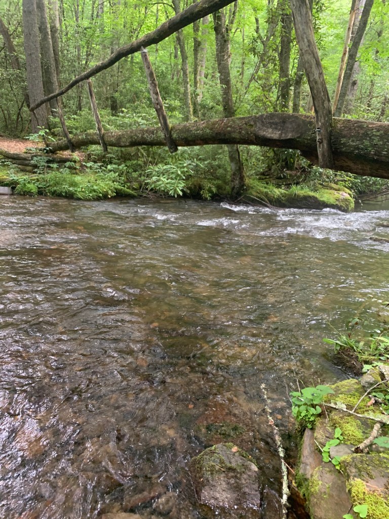
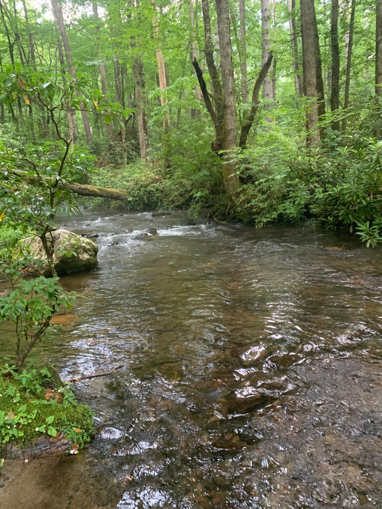

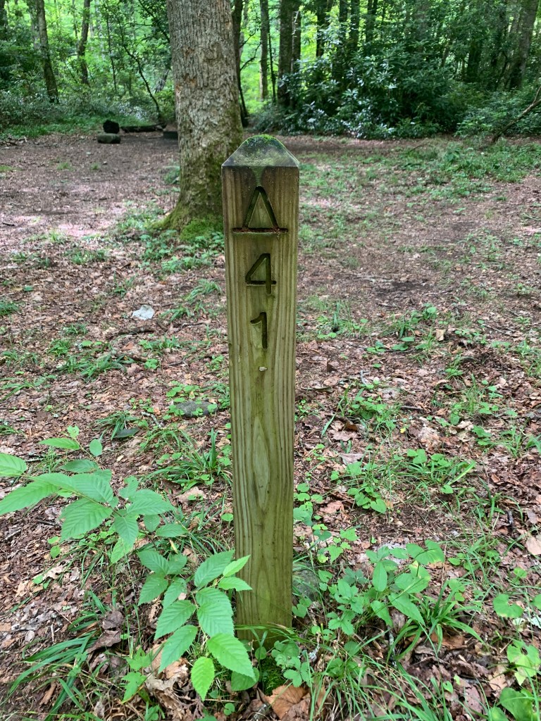
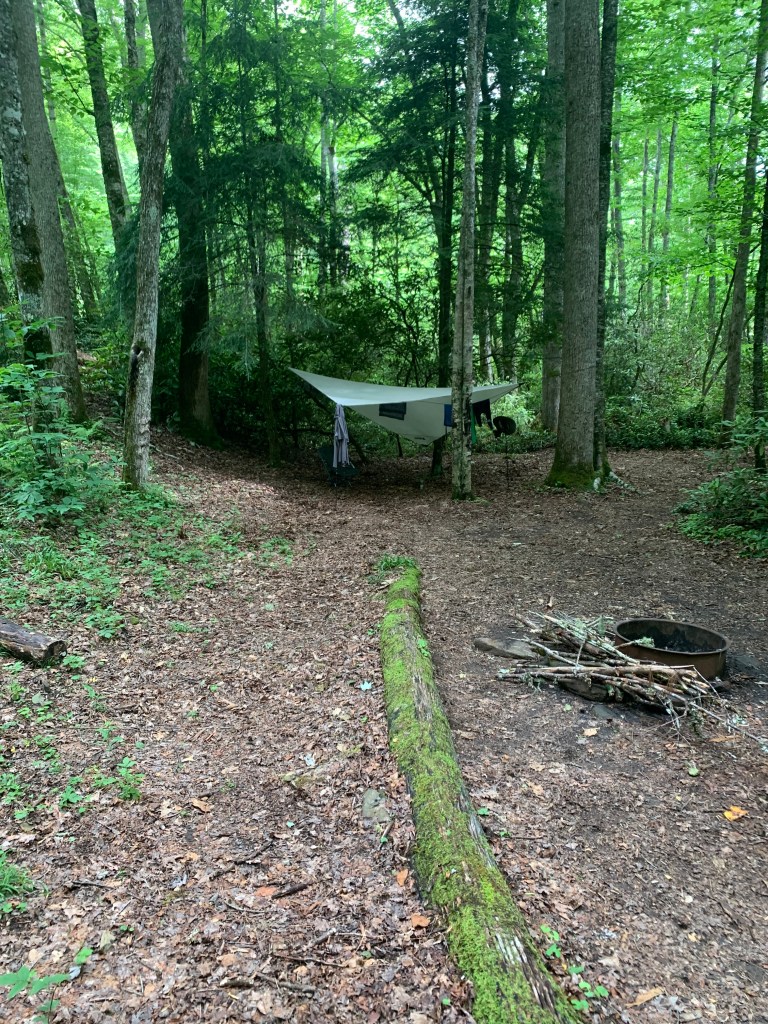
I stayed two nights at 41, just chilling on the off day (6/18). It was a nice campsite near the creek – next time, I’ll bring a fly rod. I saw 5 people while at the campsite; two of them stayed overnight on the 18th on the far side of the camping area. The REI half-dome is roomier than the Mountain Hardware tent I just retired. I only got a few sprinkles of rain the whole time, so I can’t tell yet whether it was weatherproof (weather-resistant!). The ventilation was good, like the MH tent, and the set-up was easier (the MH tent had a narrower end and the footprint and fly had to line up with the narrow tent end). I did get 10 years out of the MH tent though, but had to carry a blue tarp with me to cover it at Lake James earlier in the spring.
On the morning of the 19th, I packed up and headed uphill, west, toward the Rough Fork Trail. A short way out of camp (0.2 miles) there was a sign “Big Poplars” pointing to the right/north so I went. There was an incredibly large poplar tree at the bottom of the hill. I estimated it to be greater than 240 cm in diameter (7.87 feet for you non-math types) at chest height. It was really beautiful; pictures don’t do it justice. The video shows how it sneaks up on you.
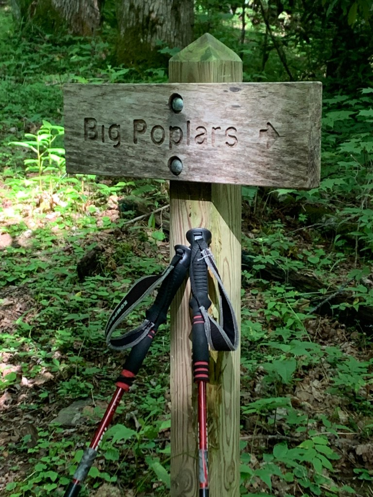
By the way, the Poplar Tree out/back hike could be an 11 miles or so day, from either end of the trail I took. You just have to contend with the long drive in and out of the Valley.
I continued westward and uphill to the junction with Rough Fork Trail and turned north. The trail here was mostly under an open canopy of oaks and hickories, and importantly, mostly downhill. I met a couple of hikers, and three of the same folks on horses along the trail.
I hiked until I got to campsite 40, sort of in an overgrown grassy area between where Rough Fork Creek and Hurricane Creek (more later) joined. I put my chair (Helinox Chair Zero) together at a small opening along the trail to the campsite to rest before setting up the tent, sat down, and the back legs of the chair sank in slo-mo to the hilt – about 8 inches! The ground there had probably never been stepped in or camped on, so it probably had centuries of leaves only. I had to roll out of the chair and extricate the legs from the ground.
The campsite (40) was nice. Only two day hikers came up to see what it was like. However, the chiggers and mosquitoes ate my legs UP! I put a note in my little Field Notes book to start bringing bug spray – and it is now in my first aid kit. That’s another thing rough about hiking in late spring, summer, early autumn that I don’t like. (3.6 miles)
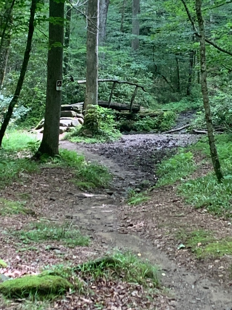
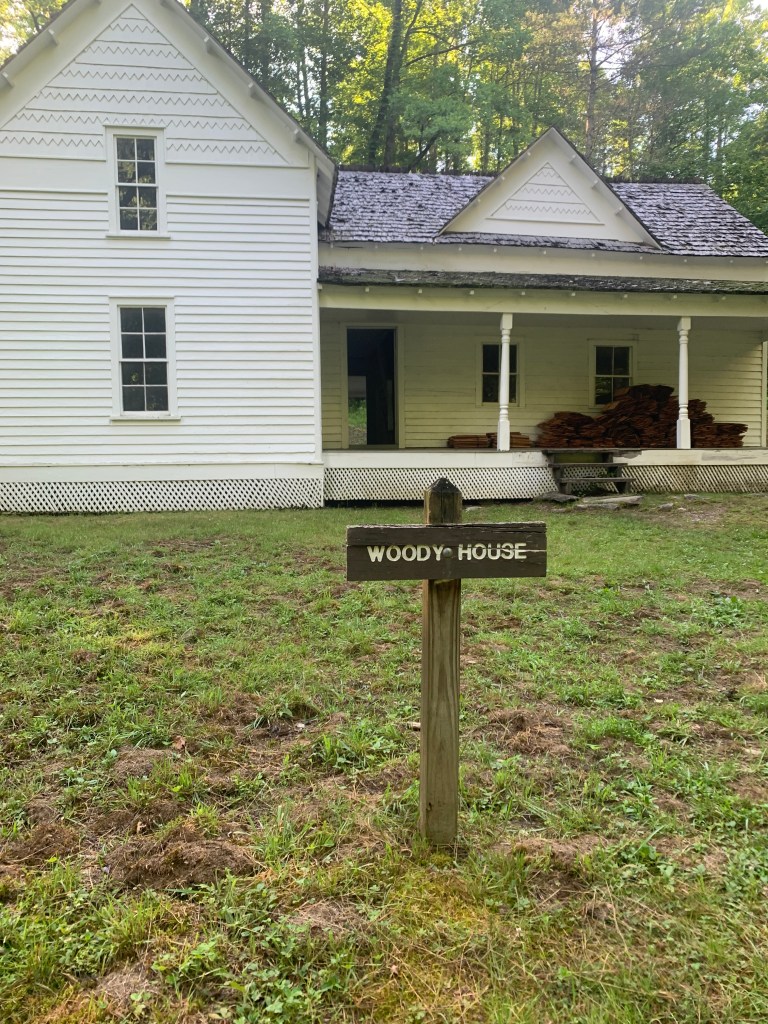
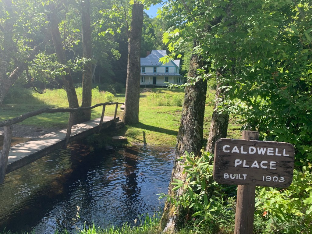
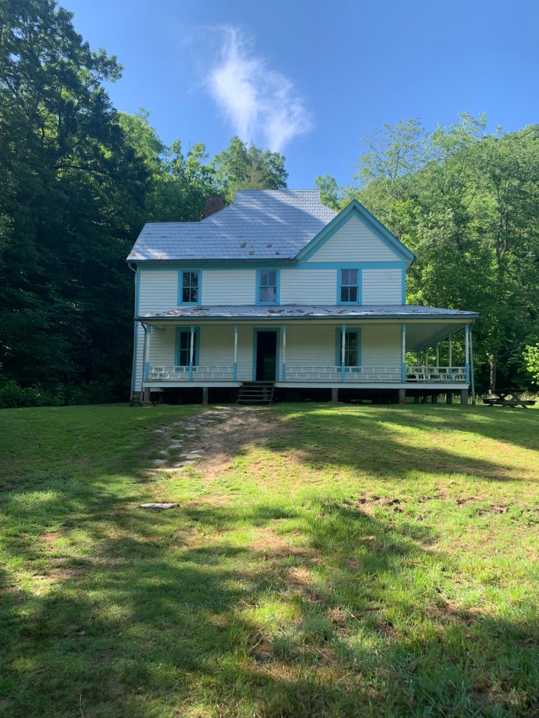
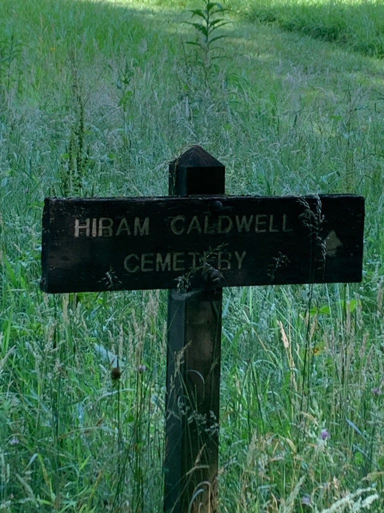
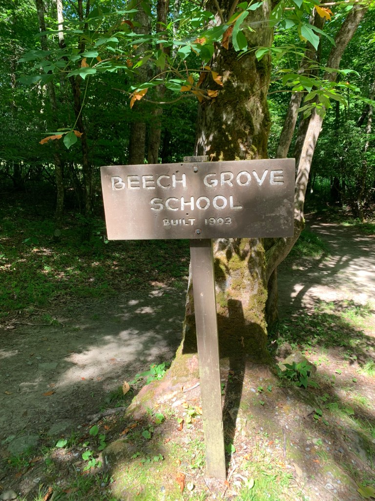
6/19/24 – I packed up and hiked out to the truck. Easy hike –along Rough Fork Trail, across several foot bridges, a stop at the Woody House. Once at the truck, I unloaded the pack, changed from boots to shoes and started the drive out. I stopped at the Caldwell House, the barn across the road, then the cemetery and school. All in all, a good three days, a relaxing hike. (1.7 miles, 11 miles total)
Notes: Hurricane Helene (remember Hurricane Creek above?) passed through in September/October ’24. A lot of the road in the lower Cataloochee Valley no longer exists; the barn was damaged; the footbridges I crossed are gone.
Some more information:
https://smokieslife.org/2024/10/17/in-the-park-cataloochee-saw-helenes-worst/: Great Smoky Mountains National Park